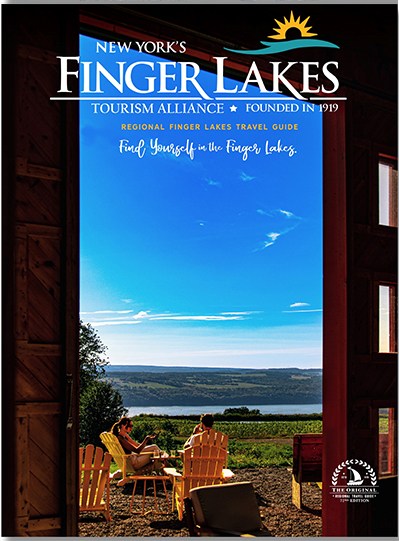
Finger Lakes Hiking Guide for Beginners
The Finger Lakes region of New York covers 9,000 square miles of rolling hills, crystal-clear lakes, jaw-dropping waterfalls, and quaint villages. You have numerous options for taking in this vast, picturesque landscape—from kayaking and boating to bicycling and snowshoeing—but sometimes, a good, old-fashioned hike is just what you need.
Hiking Basics
With a little planning and preparation, your Finger Lakes hike will be a safe, fun, and memorable experience. Here’s how to get ready for your outing.
Find a Hiking Partner
Hiking alone is not recommended, especially for beginners. If you get hurt or lost, you want a companion there with you. If you must go it alone, start with short trips to popular hiking destinations. Tell a family member or friend where you’re going and when you expect to return home.
Otherwise, ask your friends if they’re interested in hiking with you. Some may already be avid hikers who would love to impart their wisdom and let you borrow some of their gear. You can also join an outdoor and adventure-themed Meetup group. Browse upcoming events in the Finger Lakes area or schedule your own to help you find new, like-minded friends.
Choose a Hike
There are numerous trails to choose from in the Finger Lakes region. Make your decision based on these factors:
- How much time you have to hike: When estimating how long it will take to traverse a specific trail, consider that an average walking pace is about 3 miles per hour.
- The distance you want to travel: Longer hikes take more time and require a higher fitness level.
- The elevation gain: The steeper the hike, the greater its difficulty. For reference, a trail that gains 1,000 feet over one mile is considered quite steep. You’ll also want to add an hour to your trip for every 1,000 feet of elevation gain.
- Time of year: Some hikes are only accessible in the summer because of snow cover. Keep in mind that spring and fall days are also shorter, so don’t get caught out after dark unless you’re prepared to hike at night.
- Logistics: Some hikes start and finish in different places, so you’ll need to work out a way to shuttle your car to the endpoint.
Choose Your Hiking Gear
Wear comfortable, supportive shoes and moisture-wicking clothes. Then, bring a hiking backpack filled with all the gear you need, including:
- Plenty of water
- Non-perishable food
- Sunscreen
- Bug repellent
- Sunglasses
- Flashlight or headlamp and extra batteries
- First aid kit
- Emergency shelter
- Map, compass, or GPS device
Finger Lakes Hiking Guide
Follow this Finger Lakes hiking guide to make sure you don’t miss out on the most popular trails and dramatic views this region has to offer.
The Finger Lakes Trail
The Finger Lakes Trail System offers 1,000 miles of hiking from the Pennsylvania-New York border in Allegany State Park to the Long Path in the Catskill Forest Preserve. A section running through Hammondsport is particularly charming. It’s appropriate for all skill levels and rewards hikers with a waterfall at the end.
Location: Hammondsport, NY
Distance: 4.8 miles
Elevation change: 698 feet
Difficulty: Easy
Keuka Outlet Trail
Take a journey through the history of the Finger Lakes on the Keuka Outlet Trail. Multiple access points exist along the trail situated between the Keuka and Seneca Finger Lakes.
Location: Dresden, NY
Distance: 13.3 miles
Elevation change: 295 feet
Difficulty: Easy
Taughannock Falls – North Rim & Gorge Trail
Taughannock Falls State Park is named for one of the highest waterfalls in the east, plummeting 215 feet on its way to Cayuga Lake. You can hike to the falls via North Rim or Gorge Trail, both of which provide beautiful views as you head toward the climactic waterfall.
Location: Taughannock Falls State Park
Distance: 3.5 miles
Elevation change: 593 feet
Difficulty: Easy
The Inns of Aurora Nature Trail
This looping trail to the east of the Village of Aurora highlights the area’s natural beauty and historical significance. The far-reaching vistas, shady trees, and wooded ravines attract countless visitors to the Inns of Aurora Nature Trail each year.
Location: Aurora, NY
Distance: 3.5 miles
Elevation change: Minimal
Difficulty: Easy
Bishop Nature Preserve
Offering a rich mosaic of brushland, forest, and wetland, the Bishop Nature Preserve is the perfect access point to the Cayuga-Seneca Canal Trail, which runs several miles along the historic canal.
Location: Fayette, NY
Distance: .75+ miles
Elevation change: Minimal
Difficulty: Easy
Cayuga-Seneca Canal Trail
This broad, level trail passes through a tree-lined corridor. Free of obstructions, the Cayuga-Seneca Canal Trail is a pleasure to walk, run, or ride. The path follows an old railroad bed beside a canal linking the two largest Finger Lakes and passing two picturesque villages along the way—at least, it will once the trail is fully completed.
Location: Waterloo, NY
Distance: 5.2 miles (eventually 19 miles) open to the public
Elevation change: Minimal
Difficulty: Easy
Ontario Pathway Rail Trail – Stanley to Phelps
The Ontario Pathway Rail Trail is a moderately trafficked, point-to-point trail near Stanley, New York. It’s appropriate for all skill levels and provides lovely views of the local area. The trail is also dog-friendly if you want to bring your canine companion. There is ample parking at the trailhead, and the flat, dry path is accessible all year-round.
Location: Stanley, NY
Distance: 10 miles
Elevation change: 62 feet
Difficulty: Easy
Cascadilla Falls
Another popular waterfall hike, this out-and-back trail features nine gorgeous waterfalls over a very short distance. Cascadilla Falls is accessible year-round, and on-leash dogs are allowed. The elevation gain is made easier with stone steps along the path.
Location: South Hill Town Recreation Way
Distance: 1.1 miles
Elevation change: 298 feet
Difficulty: Moderate
Rim Trail and Gorge Trail Loop
This heavily trafficked loop trail features a beautiful waterfall and breathtaking views. The best times of year to visit span from April to November. Feel free to bring your dog to the Rim Trail and Gorge Trail Loop, but keep the animal on a leash. The path is stepped to make the elevation change easier.
Location: Robert H. Treman State Park
Distance: 4.3 miles
Elevation change: 820 feet
Difficulty: Moderate
Conklin Gully 12 Falls Trail
This popular trail is only recommended for experienced hikers. Due to the technical areas and slippery spots, summer is the best time to hit this trail. An optional vertical climb leads to a path you can take back to the trailhead. Or you can turn around before the climb and return the way you came. Leashed dogs are allowed on Conklin Gully 12 Falls Trail.
Location: High Tor Wildlife Management Area
Distance: 3.4 miles
Elevation change: 659 feet
Difficulty: Hard
Plan Your Trip to Finger Lakes
At Finger Lakes Tourism Alliance, our mission is to lead economic growth and development by promoting the Finger Lakes as a world-class destination. If you’re hoping to make a trip to the region, request your free Finger Lakes Travel Guide today!